Politics & Government
New Maps, Photos Illustrate Sandy's Massive Damage to Fire Island
The before and after shots illustrate where the super storm did 30 years worth of beach erosion in just one day.

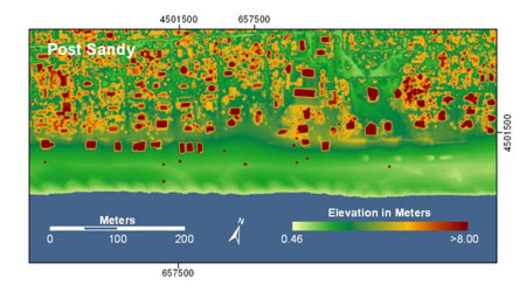
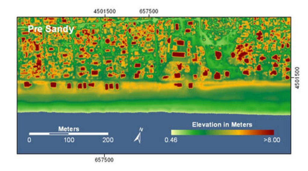

The first detailed maps and aerial photos of erosion and damage from super storm Sandy on Fire Island are available from the United States Geological Survey.
The images were taken on November 5, just days after Sandy hit the south shore of Long Island.
Sandy, according to the map information, removed sand from a 50-m wide swatch of beach and dunes on Ocean Bay Park alone. The overwash from the beach and narrow dunes carried sand inland toward the bayside of the island, destroying and damaging dozens of homes.
Find out what's happening in Sayville-Bayportwith free, real-time updates from Patch.
According to a news report at WCBS 880, the storm did 30 years of erosion damage in just one day.
“The entire coastline along Fire Island has basically been reconfigured. The dunes have moved substantially landward. A lot of the beach has eroded. And it’s very dramatic in terms of the amount of change during the course of just one storm,” the USGS’s Dr. Cheryl Hapke told WCBS 880′s Wayne Cabot.
Find out what's happening in Sayville-Bayportwith free, real-time updates from Patch.
Get more local news delivered straight to your inbox. Sign up for free Patch newsletters and alerts.